Cruise PS109
PS109 Cruise: 12th September – 13th October, 2017
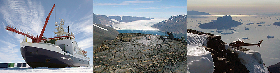
On the 12th September 2017, the marine geology group boarded the research icebreaker Polarstern in Tromsø and started another 30 days of offshore exploration on the NE Greenland continental shelf. As with the PS100 cruise, this was a multidisciplinary expedition with scientists from several nations researching the physical oceanography, geochemistry, glaciology, geodesy, geology, geophysics, atmospheric physics and chemistry as well as marine biology and biogeochemistry.
The primary aim of the cruise for us was to concentrate on objectives 1 and 2 of the NEGIS PROJECT:
- Objective 1
- To constrain ice stream/ice shelf extent and thickness in order to determine rates of retreat and re-advance between 15 – 0 ka BP.
- Objective 2
- To constrain oceanographic and atmospheric conditions and sea-level change adjacent to NEGIS between 15 – 0ka BP.
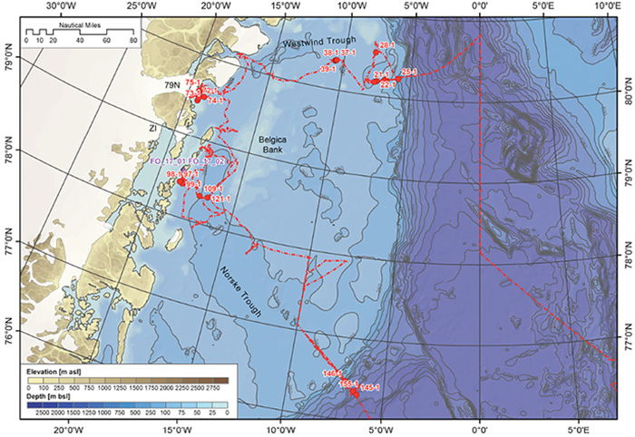
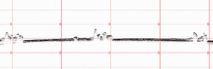
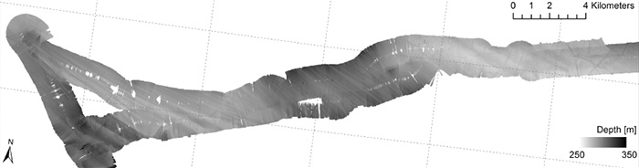
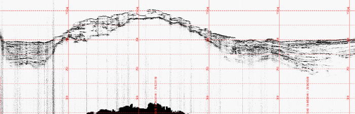
The work during PS109 built on that completed in 2016 during cruise PS100 that collected geophysical data and sediment cores from Norske Trough, the area in front of the 79N ice shelf, Westwind Trough and Belgica Bank. However, during that cruise no cores were collected from Westwind Trough, hence this trough was a major target for our core operations in 2017. During PS109 data acquisition was focused first in Westwind Trough where we collected a series of sediment cores, initially from the outer shelf-shelf edge and then from the mid-trough region (Fig. 1). These cores were selected from Parasound data and they targeted ice-marginal features in the form of moraines and grounding-zone wedges, which formed during ice sheet retreat. Parasound records from the mid-trough imaged a series of sharp-crested moraines and associated sedimentary wedges (Fig. 2). Winklemann et al. (2010) reported these previously. Extensive thick sea ice precluded coring these features where they are best developed but we were able to take several cores directly to the south in the trough. The seafloor geomorphology of this trough also shows spectacular streamlined subglacial bed forms in the form of mega-scale glacial lineations that can be traced to the outermost shelf (Fig.3).
Data collection then moved to the area in front of 79N Glacier where we collected sediment cores and acquired further multibeam and sub-bottom profiler data to supplement that acquired during cruise PS100. The embayment in front of the 79N Glacier margin is characterised by distinctive stratified basins fills, in places over 75m thick, separated by ice scoured bedrock highs that can be shallower than 100m bsl (Fig. 4). Sediment cores from this region were dominated by laminated-stratified, colour banded red and grey clays.
The final area for data collection was Norske Trough. Here we acquired two blocks of multibeam data to determine seafloor morphology around the islands of Franske Oer and Norske Oer. Here, drumlins merge southeastwards in Norske Trough with well-developed mega-scale glacial lineations recording flow of grounded ice through the trough towards the outer shelf. Cores from these region bottomed out in soft massive diamicton. Further data was collected on the outer Norske Trough and the adjoining continental slope. Acoustic stratigraphy from the continental slope offshore of the mouth of Norske Trough imaged distinctive lenticular units of, typically, acoustically homogeneous sediment ranging in thickness from a few metres to over 10m. These units commonly thin and pinch out downslope and were observed in water depths of 500m to greater than 2,800m. We interpret these as glacigenic debris flows. A series of sediment cores targeted these debris flow lenses in water depths of 600 – 2,220m. Core recovery was variable but cores up to 3m in length were recovered and bottomed out in poorly-sorted, massive grey pebbly mud consistent with a glacigenic debris flow interpretation.
In total, we collected 24 gravity cores from the outer and inner shelf, ranging from 1 to 5m in length. On this cruise we also used a multi-corer to collect relatively undisturbed samples of the water-sediment interface. The multi-corer collects short sediment cores up to 50 cm long. The multi-corer allows us to collect relatively undisturbed recent sediments enabling reconstructions of environmental conditions (particularly oceanographic conditions) covering the last few decades to centuries.
Finally, we also used helicopter support for the onshore collection of rock samples for surface-exposure dating. This approach allows us to estimate the timing and rates of glacier thickness change through time. Five sites were targeted, but due to bad weather conditions, we were unable to visit these locations. We did, however, successfully sample an alternative site on Franske Oer. The samples collected here, together with the adjacent sediment core data, will be used to reconstruct the retreat of Zachariae Isbrae onto the inner shelf.
Written by Louise Callard
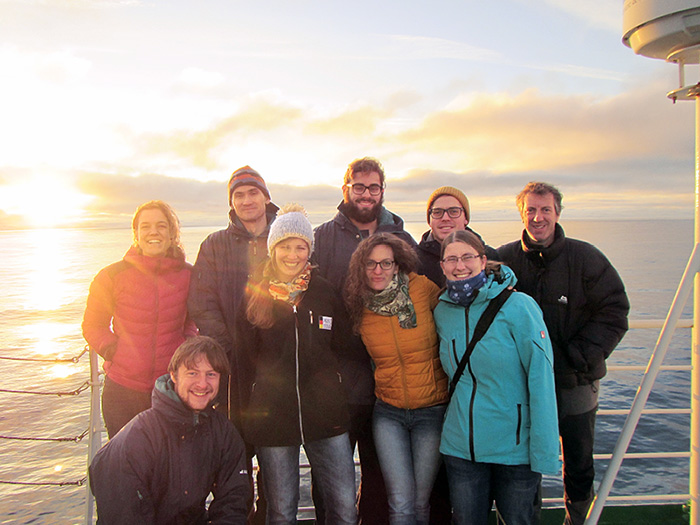
Geology team onboard PS109
- Colm Ó Cofaigh
- Jerry Lloyd
- Richard Selwyn Jones
- Peter Codling
- Katharina Streuff
- Flor Vermassen
- Maria Kappelsberger
- Nicole Syring
- Michaela Meer
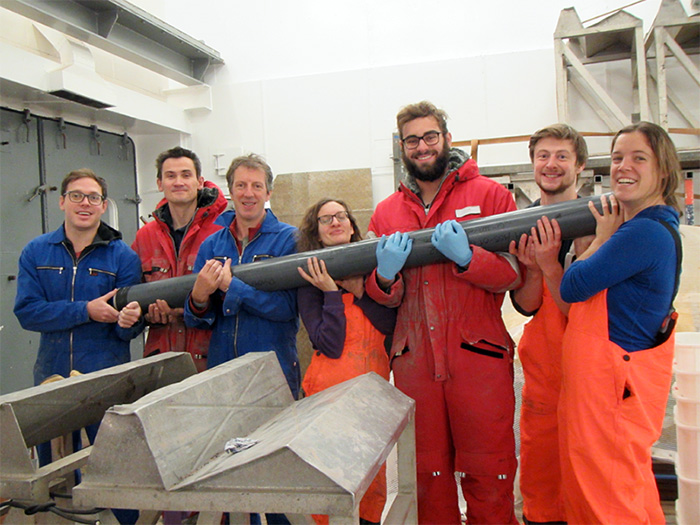
Jerry Lloyd, Nicole Syring, Peter Codling, Flor Vermassen, and Katharina Streuff).
Colm Ó Cofaigh, Peter Codling, Richard Selwyn Jones, and Jerry Lloyd.
Front row (from left to right): Flor Vermassen, Maria Kappelsberger, Nicole Syring and, Michaela Meer.